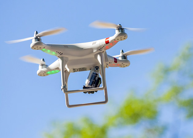
It seems Econet is diversifying their IoT platform to also include drone services. Through their subsidiary, Cumii, they are venturing into offering drone services in different sectors.
Cumii is a subsidiary of Econet Global and they focus on IoT solutions in various industries. They focus on various industries including connected health, connected assets (e.g. cars) and connected lifestyle. Apart from IoT solutions, Cumii also offer on demand services through their technite program.
Anyway, there seems to be new activity in the Cumii camp…
Whats new?
Cumii’s website recently added a new Drone Africa page and the page states:
Drone Africa provides services that render drone solutions across multiple verticals within Africa. Some of the solutions offered are ;
-
Agriculture- Multispectral Surveying and Spraying
-
Game Monitoring – Anti-poaching initiatives; search and rescue
-
Asset Maintenance – Cellphone Tower Maintenance, Power Line Inspections and Solar Panel Inspections.
-
Video and Photography
-
Mapping and surveying
This is a diverse set of services they are looking to offer but it’s not entirely unheard of and they may be taking inspiration.
Insuring the agric industry
In South Africa, drone technology has been used in the insurance industry. Aerobatics is one such company that is in such industry. They use aerial imagery along with machine learning algorithms to provide insurance solutions. This technology is being used with the intention of lowering costs in crop insurance so that may be the route that Cumii decides to take with their Drone Africa venture.
Wildlife
In Malawi, Liwonde National Park has deployed drones with thermal camera’s for surveillance purposes and here’s an interesting article on how they’ve been using the camera’s to limit poaching. These are probably some of the initiatives Cumii will be targeting with the Drone Africa service.
Mapping
Drones have also been used in Africa in order to map land boundaries and also help with land ownership issues, which tends to be an issue in Africa. In Africa so far only 30% of land boundaries have been mapped so if Drone Africa is implemented properly it could really help with this situation locally. I’m not really sure if Drone Africa is the first in Zimbabwe to move into this space but regardless they offer a welcome entry in this space.
7 comments
Well done Cumii….I am not surprised!
Fantastic Stuff
Seriously…. Mapping? I’ll stick with free google & apple satellite maps, thanks.
You know there are all kinds of maps, right?
You know there are all kinds of maps right?
Way to go guys
Econet can’t be having a shot at everything. Do these guys have any rational business model? Indeed, their fanboys will now come after me.