The economy is in a tailspin, there are three or more exchange rates out there and civil servants are severely underpaid but we are going to space next month everyone! Yeah… I know, for most of you this really isn’t news because this whole Zim space adventure thing is something that has been rumbling for nearly 4 years since the government launched the Zimbabwe National Geospatial and Space Agency (ZINGSA) way back in 2018 and vowed to get the country’s first satellite (ZimSat-1) in orbit.
If we are keeping track, this launch has suffered a five-month delay because last year it was reported that the nanosatellite would be in orbit by February this year. According to a report by The Sunday Mail, the delays were caused by the COVID-19 pandemic, which affected the launch of the Japanese KIBO module.
“Everything is now ready; we received a report recently indicating that it was tested and approved for flight. We have our engineers on the ground in Japan who are making sure everything goes according to plan.”
Painos Gweme, ZINGSA Coordinator (via Sunday Mail)
Anyway, it’s easy to throw out the baby with the bath water on this one (and I intend to do a little of that later), however, the first question we need to address is…
What is a nanosatellite?
If this launch is successful and on time, Zimbabwe will join the likes of Egypt, South Africa, Ghana, Nigeria, Ethiopia, Morocco, Kenya, Rwanda, and Mauritius as the only African countries to have a satellite in orbit.
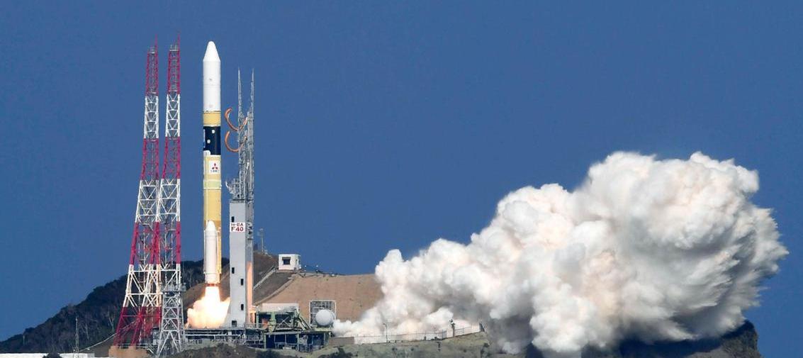
ZimSat-1 is going to be a nanosatellite which is just a fancy way of saying a very small satellite. Nanosatellites, typically weigh less than 10 kilograms, however, the exact specifications of ZimSat-1 were not revealed.
The small size of the craft means that it is cost-effective compared to much larger ones that are in orbit because they weigh less and take up less space which results in them being transported with other instruments and equipment that might also need to go into space on the same space shuttle.
Ok… so what is ZINGSA going to be using the satellite for?
The use case for a nanosatellite depends on what equipment it has been fitted with. There were no details shared in the report by the Sunday Mail on what the team from Kyushu Institute for Technology in Japan who built the craft put on it.
However, there was mention of the spacecraft being used for mapping to support ZINSGA’s National Wetlands Masterplan. This initiative was launched in June last year and had a comprehensive map of the country’s wetlands across all 10 provinces. Additionally, ZINGSA is reportedly also going to use the nanosatellite to monitor, environmental hazards and droughts, map human settlements, disease outbreaks, as well as improve mineral exploration.
Time to throw out that baby
I am all in for technology that helps enhance how we do things, but if it comes at too great an expense or we have technology that can solve that problem already then it’s probably not worth exploring. As I mentioned earlier, we have some serious problems in Zimbabwe. The state of our national infrastructure, for example, is so dire… The roads and public transport network are areas that need to be addressed and whatever money was dedicated to this satellite could have been redirected to solving a number of the terrestrial problems we have.
Anyway since the government’s space adventure is signed and sealed I’ll circle back to the two points I made earlier. The first point alluded to how much this will cost, well… there are no answers there. As far as I am aware there isn’t anything I have seen that suggests how much this will cost the taxpayer. Moreover, there are a number of figures floating online about costs for similar programs, however, what ZimSat-1 comprises of is information that I have yet to come across.
However, the second point, which was about existing technology, is something that we can speculate on because the report from the Sunday Mail said that ZINGSA is currently carrying out aerial mapping of urban settlements to identify dysfunctional, illegal and irregular settlements. How ZINGSA is doing this is currently unknown, but we can speculate that they’re doing so through the use of another country or a private company’s satellite or they have enlisted drone technology.
Drones are incidentally part of ZINGSA’s scope of operations as it says the organisation, on top of space exploration, is also…
“Responsible for designing, promoting, coordinating and conducting research and development initiatives that promote advances in Geospatial Sciences and Earth Observations, Space Engineering, Space Science, Aeronautical Engineering, Mechatronics, Satellite Communication Systems, Global Navigation Satellite Systems (GNSS), Land Positioning Systems, Unmanned Aerial Vehicles (UAV) and Launch of Satellites.”
ZINGSA
This, at least to me, suggests that ZINGSA, after 4 years of operation, is probably well acquainted with drones and has been using them to do work similar to what ZimSat-1 is going to be doing.
Furthermore, the cost to operate a fixed-wing drone (like the DeltaQuad Pro) that can gather data over hundreds of kilometres is far cheaper than it would be to commission and send off a satellite. On top of that, ZINGSA as a government agency would be pumping some cash into local drone startups like Scout Aerial, Precision Aerial and Drone Solutions Academy much like what ZESA has been doing.
Is ZimSat-1 yet another of the govt’s vanity projects?
Without knowing the exact cost to make an appropriate comparison with drones. I don’t think we can answer this question in any way that I would see as satisfactory, but you are more than welcome to take a stab at it in the comments.
My opinion is that we should put more emphasis on growing local capacities where we can, particularly with how many Zimbabwean startups are caught between “the economic rock and hard place“. I am not opposed to the idea of a satellite, however, if we look at the litany of issues we have on the ground, going to space is one of those things we should have put a pause on.
Cover Image Credit: SpaceWatch.Org
What’s your take?